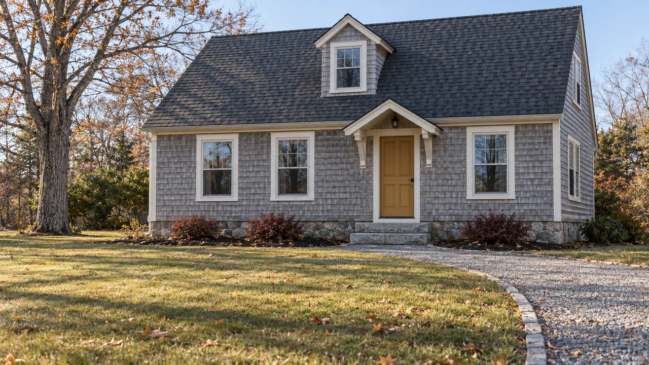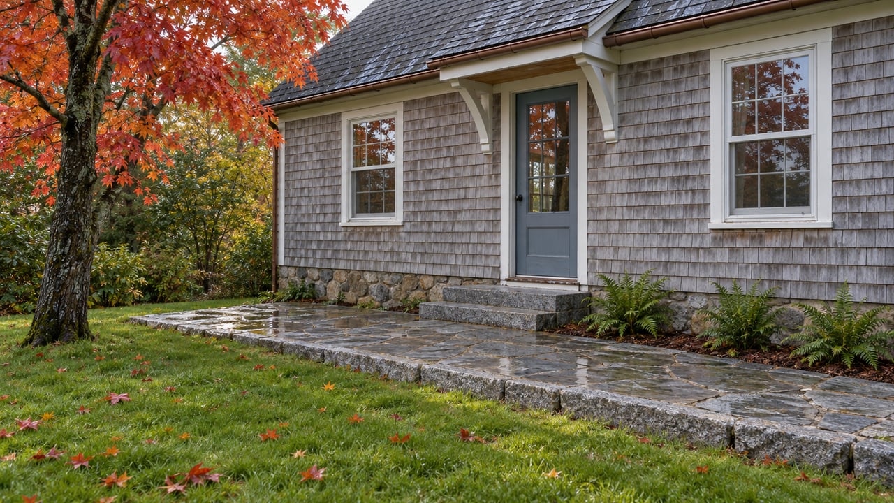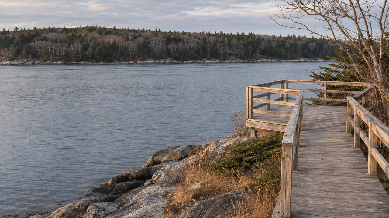
Blue Hill Heritage Trust's newest preserve is a 635-foot path at the end of Ferry Landing Road in Sargentville. It ends at a platform that looks out on the half-mile of Eggemoggin Reach the Deer Isle ferry crossed for close to 150 years. The trust scheduled the official opening for Tuesday, November 10, and the preserve page now carries the trail map and use guidelines. The grade averages 1.6 percent, so the walk works for nearly everyone, and it gives anyone who can't manage a rocky shore path a seat facing the crossing that shaped Sargentville.
| The Landing at a glance | |
|---|---|
| Address | 48 Ferry Landing Road, Sargentville |
| Preserve size | 15.3 acres, with more than 400 feet of shoreline |
| Accessible trail | 635 feet out, 0.24 miles round trip |
| Grade | 0 to 4.5 percent, averaging 1.6 percent |
| Surface | Hard-packed gravel, then white cedar boardwalk |
| Parking | Three cars, with overflow at the end of the road |
| Dogs | Allowed on leash and under control |
| Hunting and trapping | Permitted on the property |
Getting there without blocking the launch
The Landing shares a dead-end dirt road with the town boat launch and a handful of neighbors' driveways, so how you park matters as much as the directions. Blue Hill Heritage Trust gives the route this way:
- Take Reach Road, which is Route 175, east from Route 15.
- Turn right onto Ferry Landing Road. It's a dirt road.
- Watch for the Landing parking area on the left near the end of the road. It holds three cars.
- If those three spaces are taken, use the overflow at the end of the road, keeping the boat launch and every driveway clear.
For the opening, the trust told visitors that parking was limited and asked them to carpool. That advice still makes sense for a nice weekend afternoon, when three spaces fill quickly.
The rules are short. Stay on the trail and carry out whatever you bring in. Dogs need to be leashed and under control. The preserve is foot traffic only, with no bikes, motor vehicles, fires, overnight stays or camping.
The walk, and what sits at the end of it
The trail starts on hard-packed gravel and turns into a white cedar boardwalk, with rest areas along the way. It ends at a viewing platform looking at Deer Isle and the Reach. The steepest stretch is 4.5 percent, gentle enough for a stroller, a cane or a wheelchair user with some help. A slow walker can be out and back in a few minutes.
The view from the platform takes in three directions. The trust's preserve page lists the Deer Isle–Sedgwick suspension bridge to the west, the Deer Isle Causeway to the south and islands along the horizon to the east. All three are pieces of one story. The bridge and the causeway are the two pieces of infrastructure that ended the ferry that gave this road its name.
A half-mile that used to take planning
The Island Institute's history of the bridge puts the distance across the Reach from Little Deer Isle to Sargentville at half a mile. It traces a ferry over that gap to April 17, 1792, when the town hired John Scott to row islanders across. In 1807 the town gave him $80 to build ferry landings on both sides, and generations of the Scott family kept the service going.
The same article quotes Hilda Eaton Stacher, who grew up on Little Deer Isle, describing that crossing in a 1989 newspaper piece:
"When I was growing up and we went to the mainland, we had to consider not only the departure time of the last ferry, but also the periods of low tide. One of the great frustrations of life was to arrive at the ferry landing and see the last ferry halfway across the Reach, heading towards North Deer Isle."
According to the Island Institute, the ferry stopped at 8 p.m. In the years before the bridge it ran a barge with a lobster boat tied alongside that carried four cars at a time. In summer, as many as 40 cars at a time could be seen lined up at Sargentville. In March 1933, drivers arrived on the Sargentville side, found the ferry shut down by high winds, waited all day, drove back to Blue Hill for the night, and returned at 8 a.m. the next morning to wait until 3 p.m. before getting across. In the winters of 1934 and 1935 the Reach froze solid enough that some drivers crossed on the ice.
The causeway to the south of the platform was approved in 1927. It took until 1938 to finish, and it follows the winding course people once picked across the flats at low tide from Little Deer to Deer Isle. The bridge to the west followed shortly after. Federal engineers first wanted 100 to 110 feet of clearance, and the final design came down to 85 feet, still tall enough for pleasure yachts to pass under. Governor Lewis O. Barrows cut the ribbon on the $900,000 project on June 19, 1939.
That means the ferry ran from 1792 to 1939, about 147 years, across the water you see from the end of the boardwalk. The bridge has stood for 87 of the years since.
Why this stretch of shore is open to everyone
The Landing is public because a family chose to sell it to the trust. In a 2024 essay on Blue Hill Heritage Trust's site, Michael Rossney describes the 15.3-acre parcel down Ferry Landing Road as part of Edgehill. His family has summered there since an ancestor bought the property in 1905.
He calls the waterfront piece "one of the largest un- developed parcels anywhere along The Reach." With help from a land-use consultant, 11 siblings, cousins, aunts and uncles formed an LLC and spent years working with the trust on the sale, which had to clear a long list of state and federal agencies. The family put the proceeds into restoring the old house and barn.
Writing in 2024, before the trail was built, Rossney mentioned plans for an accessible path and described the beach, shore bluffs, marshy areas, cedars and hardwoods as "there for everyone to discover." The trust's preserve page thanks the previous owners "for having the vision to work with us to conserve this beautiful place," and the opening notice credits the donors who paid for the land acquisition and the trail.
Walking it before the end of November
Late November brings one practical issue. Hunting and trapping are permitted at The Landing. The Maine Department of Inland Fisheries and Wildlife lists the 2026 firearms deer season as running statewide from November 2 through November 28. Through that Saturday, it's sensible for you and your dog to wear blaze orange, even on a 635-foot trail that never leaves sight of the road.
The preserve page doesn't list hours or say whether the trail is maintained in winter. Before heading out after a storm, check the trust's page for The Landing or call the office at 207-374-5118.
How it fits with the peninsula's other easy trails
The Landing joins four other trails on the trust's increased-access page, and the Sedgwick one sits just up Route 15.
- Cooper Farm at Caterpillar Hill, also in Sedgwick, has its own accessible trail map.
- Meadow Brook–Mill Stream Conservation Area in Brooksville has a six-foot-wide gravel route of about a third of a mile, with two easy-to-moderate inclines.
- Hundred Acre Wood in Brooklin has an inner loop of packed crushed gravel just under half a mile long and a 1.7-mile wooded loop.
- Murphy Trail, part of the Heart of Blue Hill trail system, is a crushed-gravel path through the woods that suits strollers and people with limited mobility.
At about a third of a mile, the Brooksville route is more than twice as long as The Landing's 635 feet. Our Sedgwick post from August followed how much of the town's shared life runs along Route 15. The Landing adds a public spot on the Reach just off Reach Road.
If the walk out to the platform makes you curious about Sargentville and the rest of the shore along the Reach, Laura Pellerano is happy to share what she knows about Sedgwick and its waterfront. Let's Connect.